Southern Great Plains Wind Erosion Maps
1936 -1937
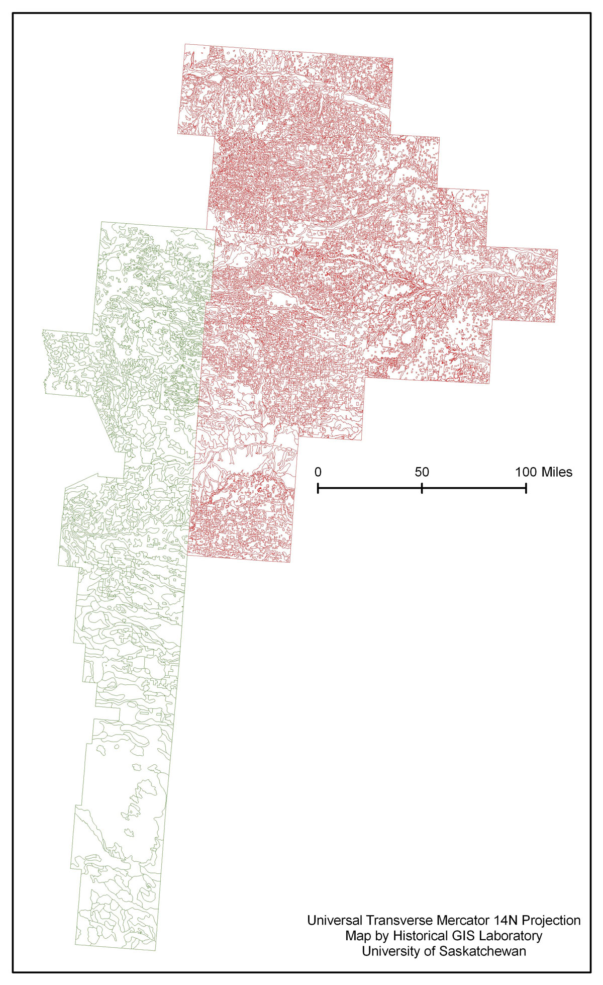
This is a project undertaken by the HGIS Lab in support of Geoff Cunfer’s research about the history of dust storms on the Great Plains. It originated with a remarkable find in the U.S. National Archives Cartographic and Architectural Section in College Park, Maryland. In the mid-1930s, in the midst of the Dust Bowl, the U.S. government conducted a detailed reconnaissance survey of the hardest-hit wind erosion area on the southern Great Plains. The Soil Conservation Service created 32 county maps showing, in great detail, the soil characteristics, slope, land use, and erosion status of individual farms across some 30,000 square miles. These large maps had never before been used systematically by historians of the Dust Bowl.
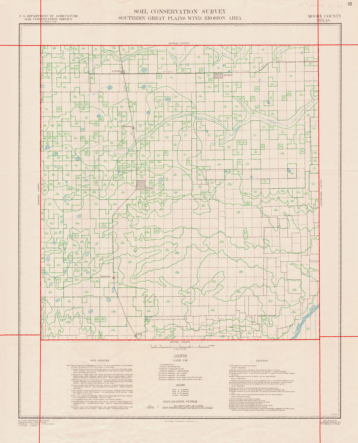
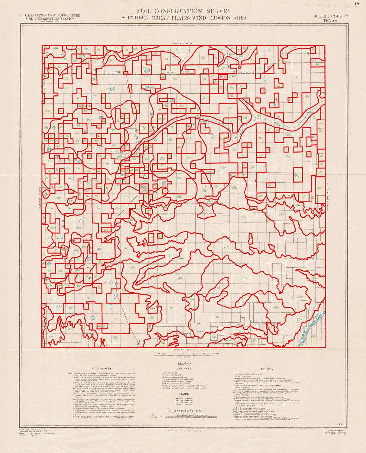
With research support from the Canadian Social Sciences and Humanities Research Council (SSHRC) the Historical GIS Lab undertook the project to digitize these unique maps and bring them into a GIS for new analysis. Since documents cannot leave the National Archives, we hired a local company to go into the archives and scan them for us as 300 dpi color images. We then georectified the images and Lab staff digitized the complex polygon map features.
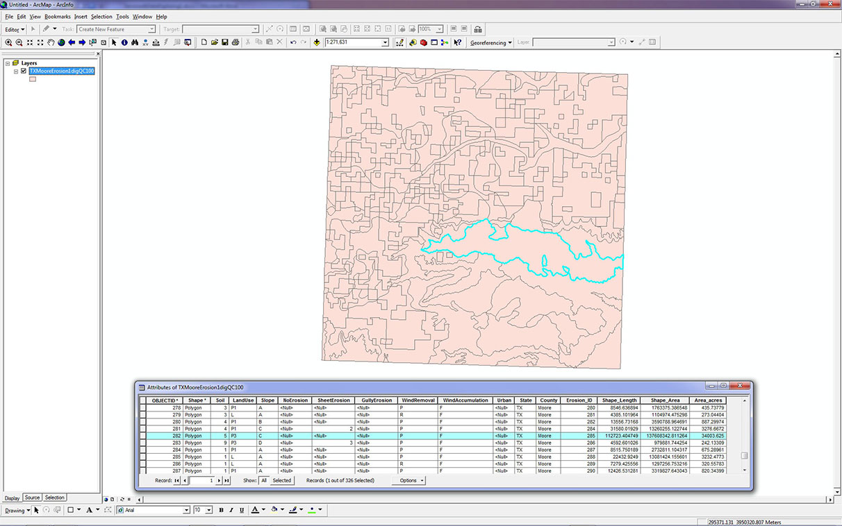
The original maps included a complex attribute code inside each polygon, which we duplicated in our attribute table.
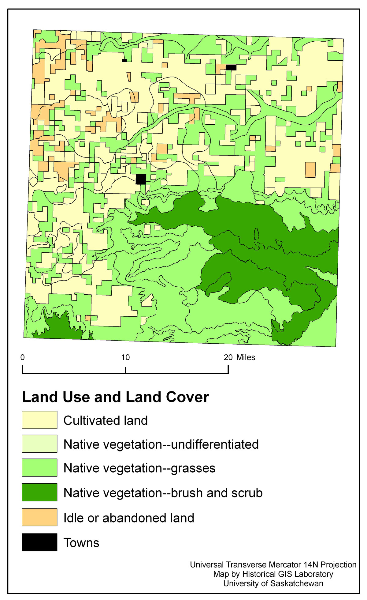
We digitized each map separately, so the next step was to mosaic the electronic layers together into a single surface, and to edgematch the places where adjacent maps touch one another. The result is a highly detailed historical GIS of land use and wind erosion conditions in the midst of the 1930s Dust Bowl. The mosaicked image brings together all 32 maps in a single space for the first time, with a combined 14,000 polygons represented.
With the data creation work complete, it is now possible to map separate land use and erosion characteristics, to cross-analyze them, and to overlay them with other maps for comparison.