Northern Great Plains Land Use
1920 - 2000
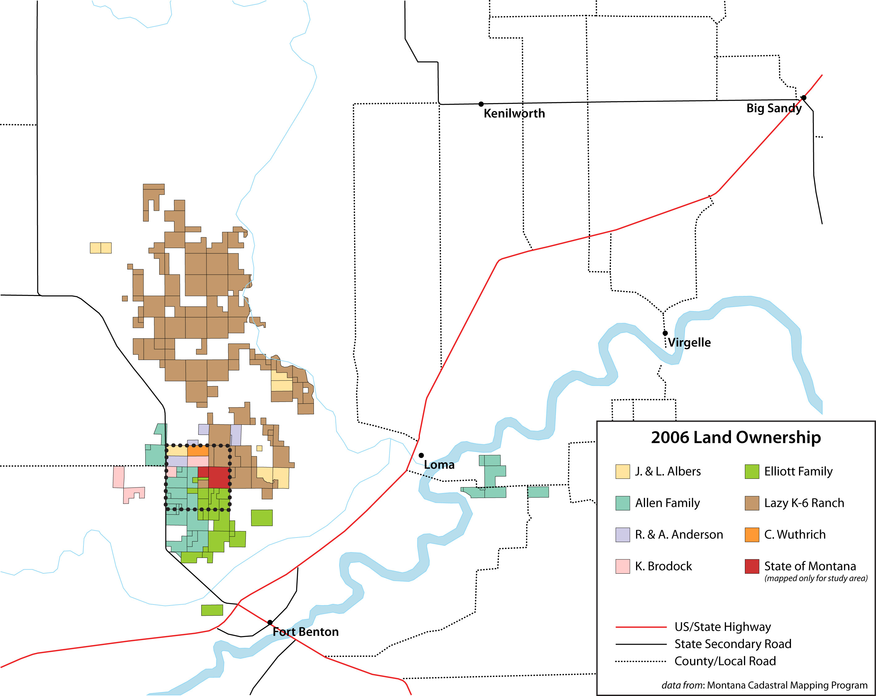
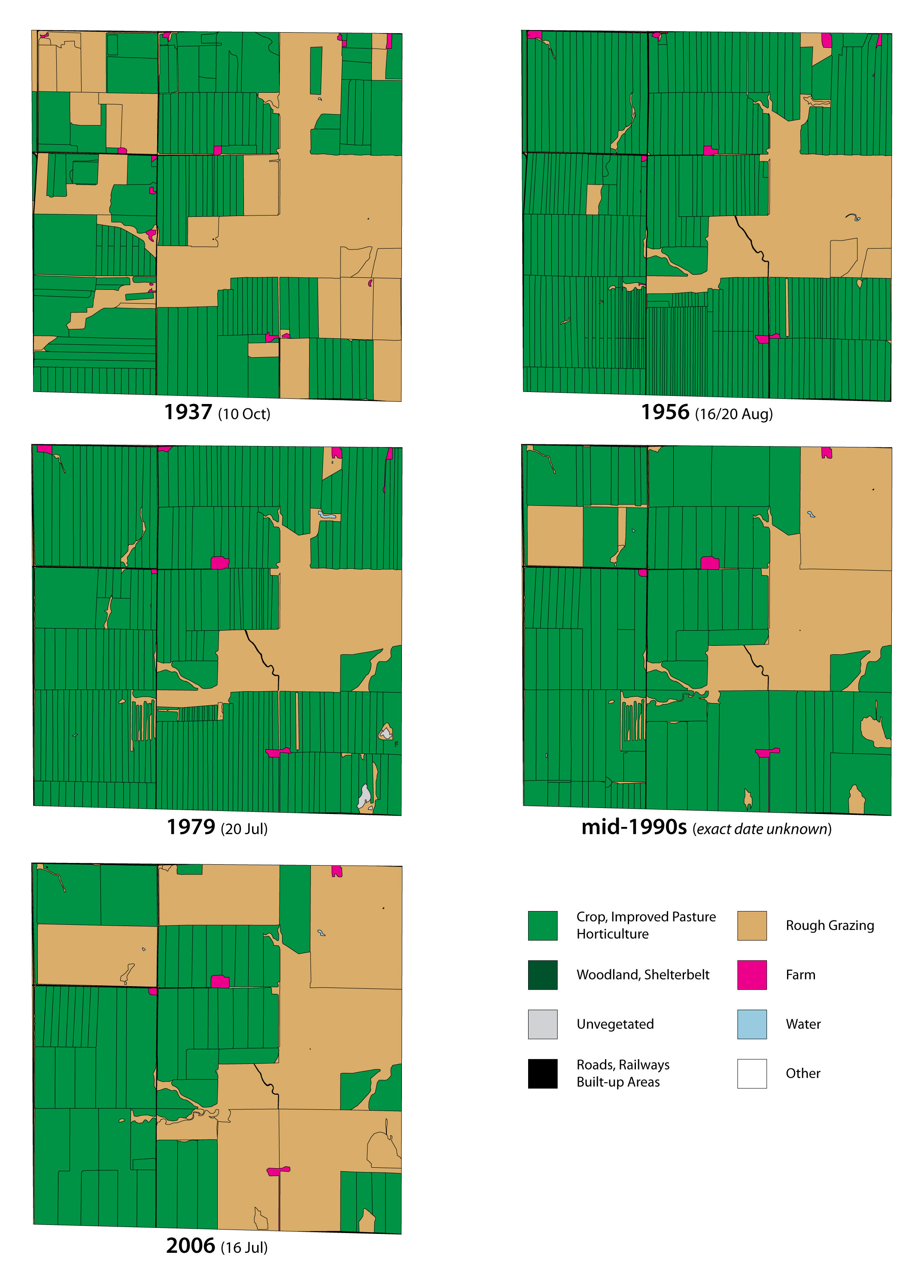
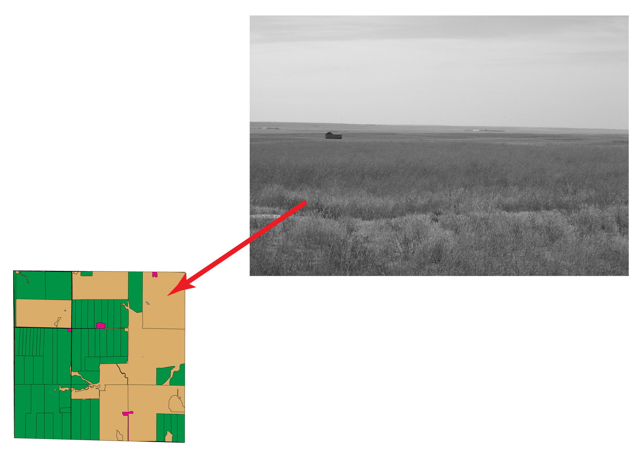
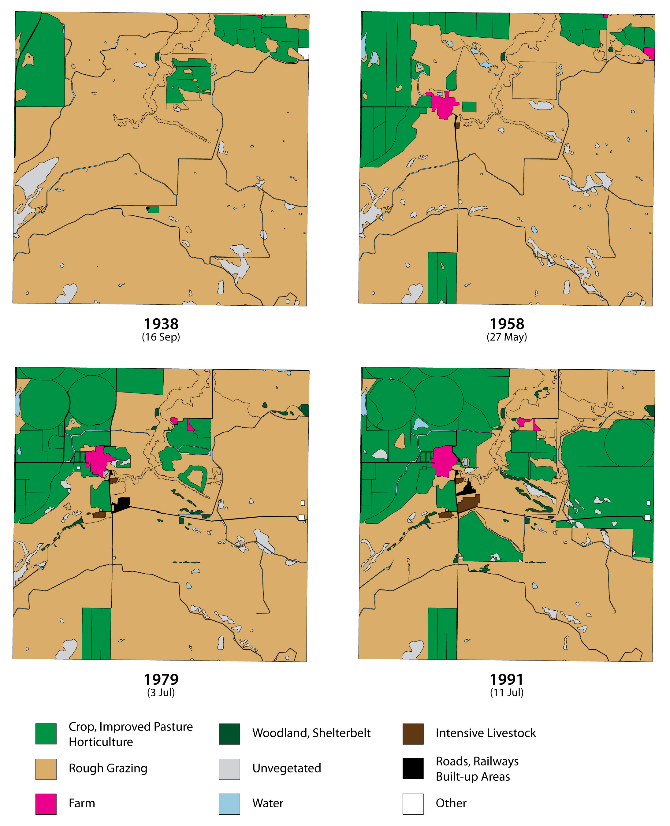
This project is part of the Great Plains Population and Environment Project and Andrew Dunlop’s Ph.D. dissertation research. To compare changing agricultural land use on either side of the Canada-U.S. border during the 20th century, Dunlop collected a sequence of aerial photos from the archives, some dating as early as the 1920s. Bringing the land cover information revealed by these photos into a historical GIS allowed him to track evolving land use patterns across 80 years at sample sites in Montana, North Dakota, Alberta, and Saskatchewan.