Saskatchewan Métis Traditional Land Use Survey
1936 -1937
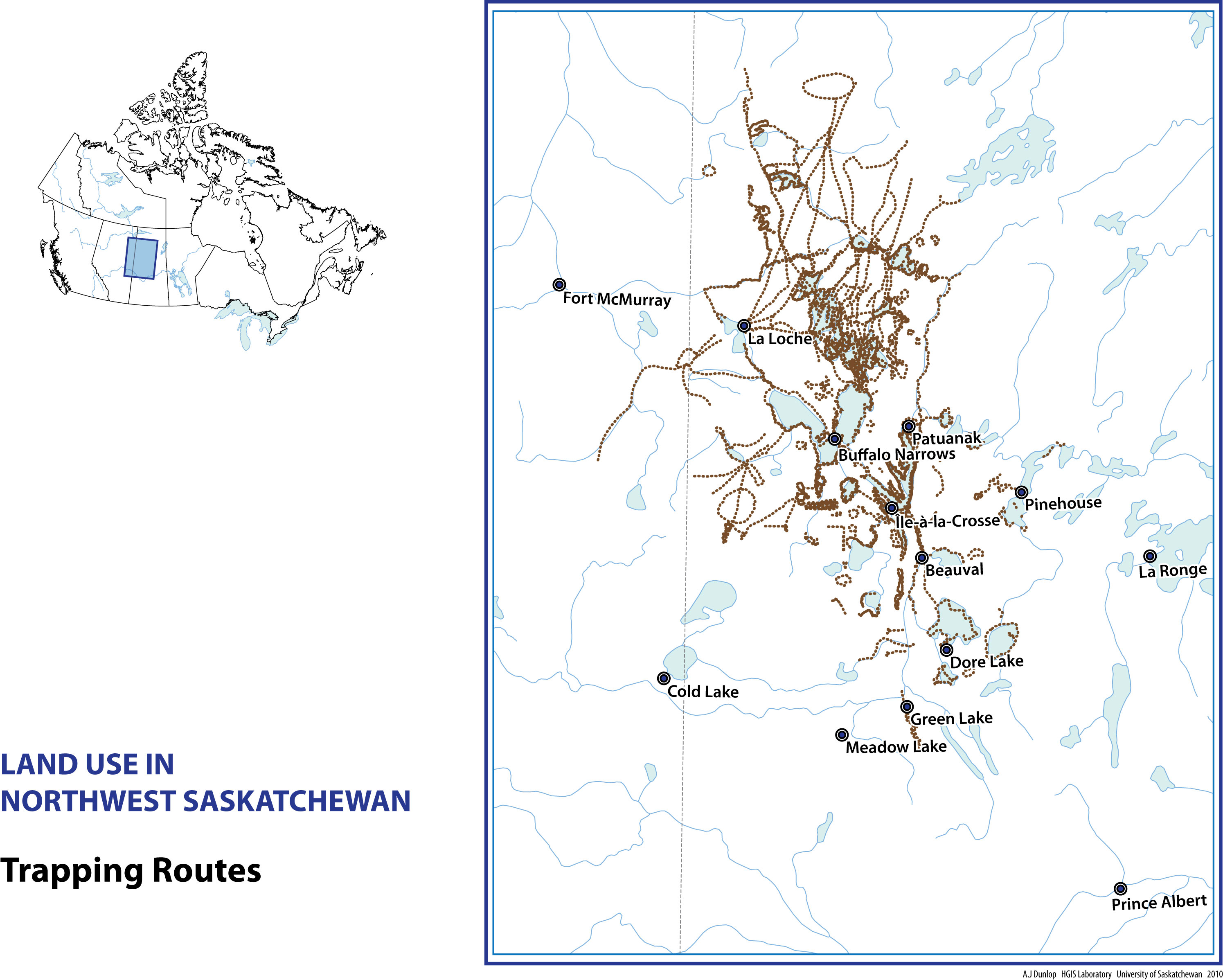
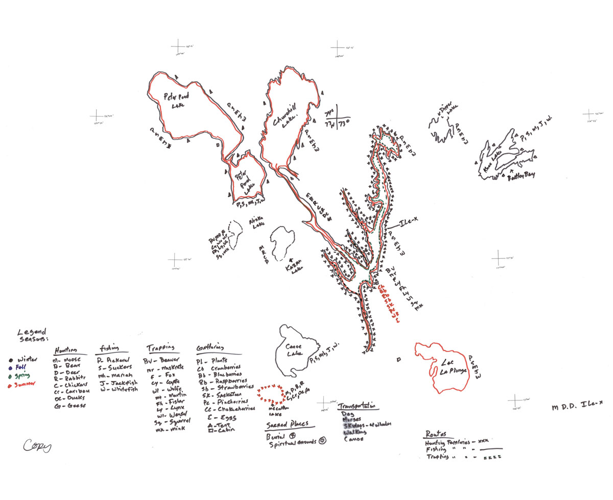
As part of a Traditional Land Use survey, the Saskatchewan Métis Council, collaborating with researchers at the University of Saskatchewan, conducted several hundred oral history interviews with community members about their hunting, trapping, fishing, and gathering activities in northwestern Saskatchewan during the past three generations. Respondents hand-drew maps showing their traditional trap lines, fishing areas, berry and egg gathering sites, and hunting grounds. The result was a rich collection of recorded interviews and land use maps.
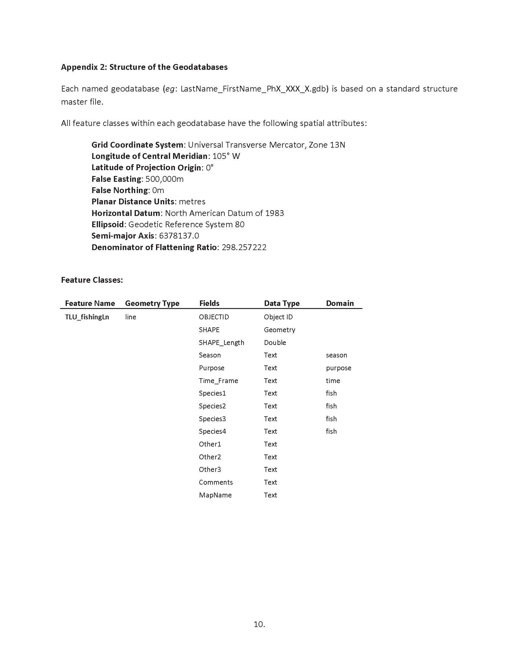
The research team contracted with the HGIS Lab to create a fully attributed GIS that combines information from all of the map material into a single place for cumulative analysis. The original maps had been drawn in the field on mylar sheets taped over top of topographic maps. We scanned these mylar sheets with our wide-format scanner, then georectified the images to Canadian National Topographic Survey (NTS) maps.
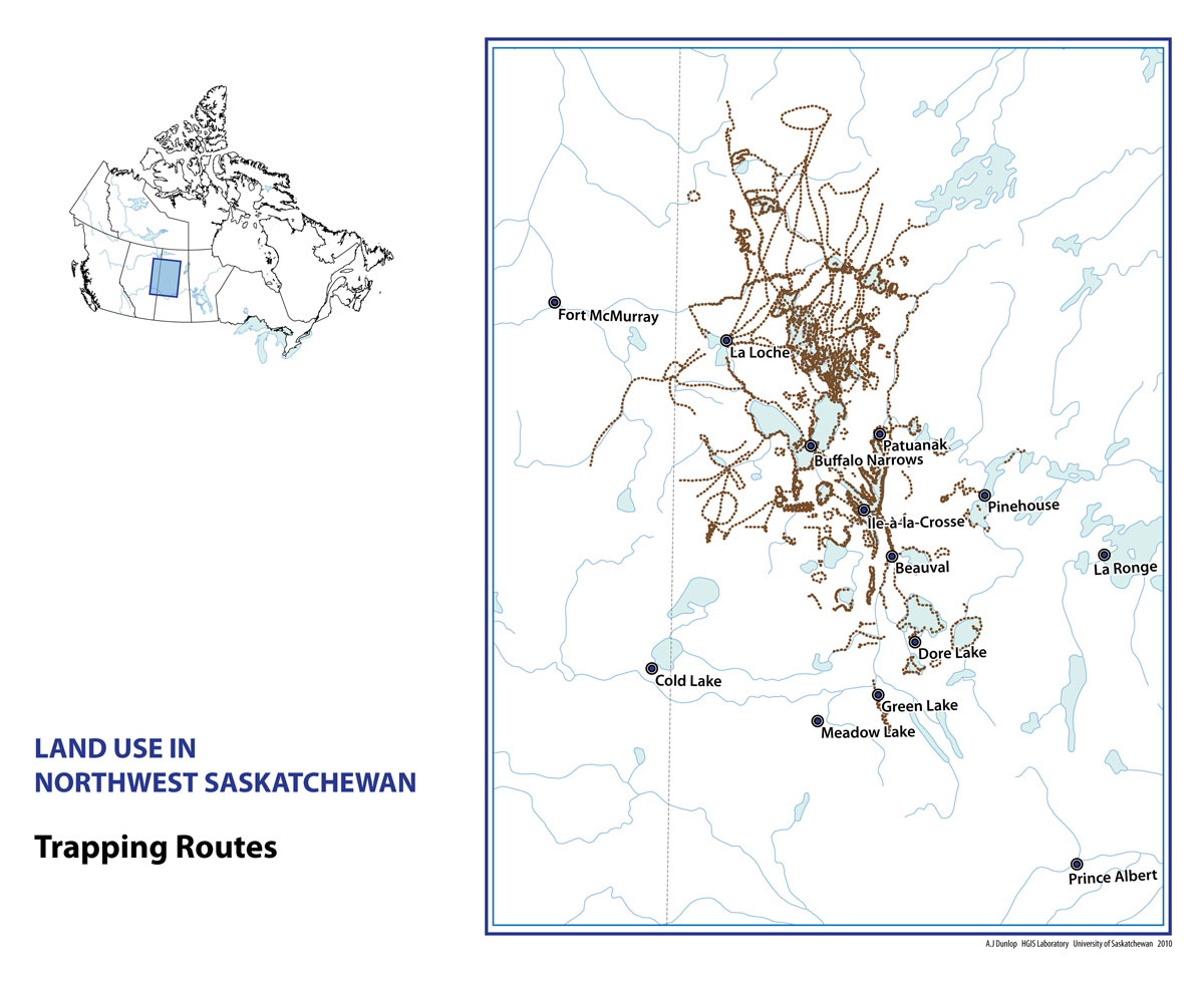
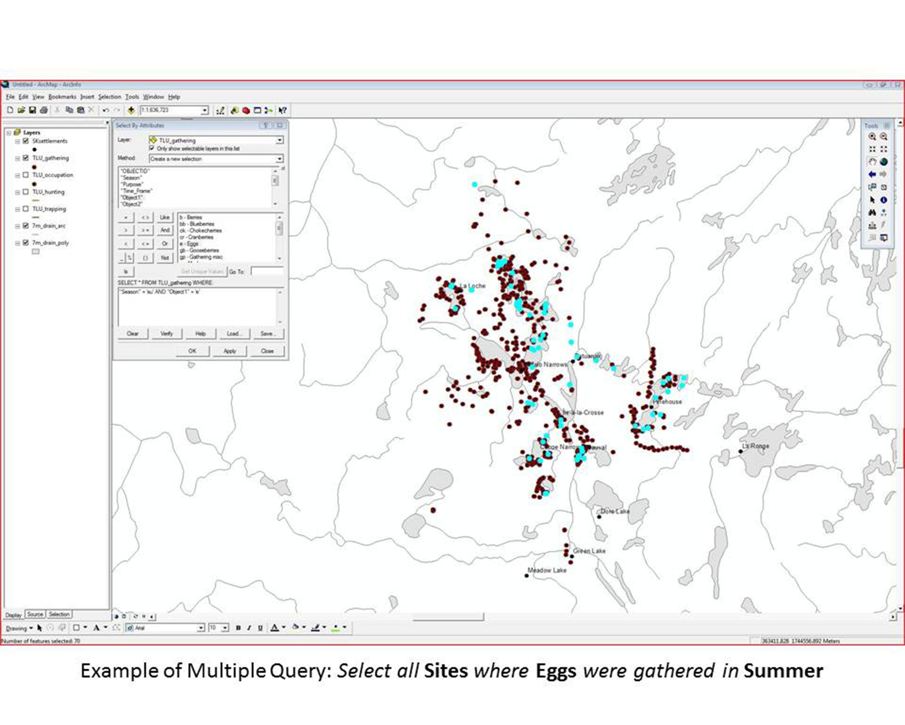
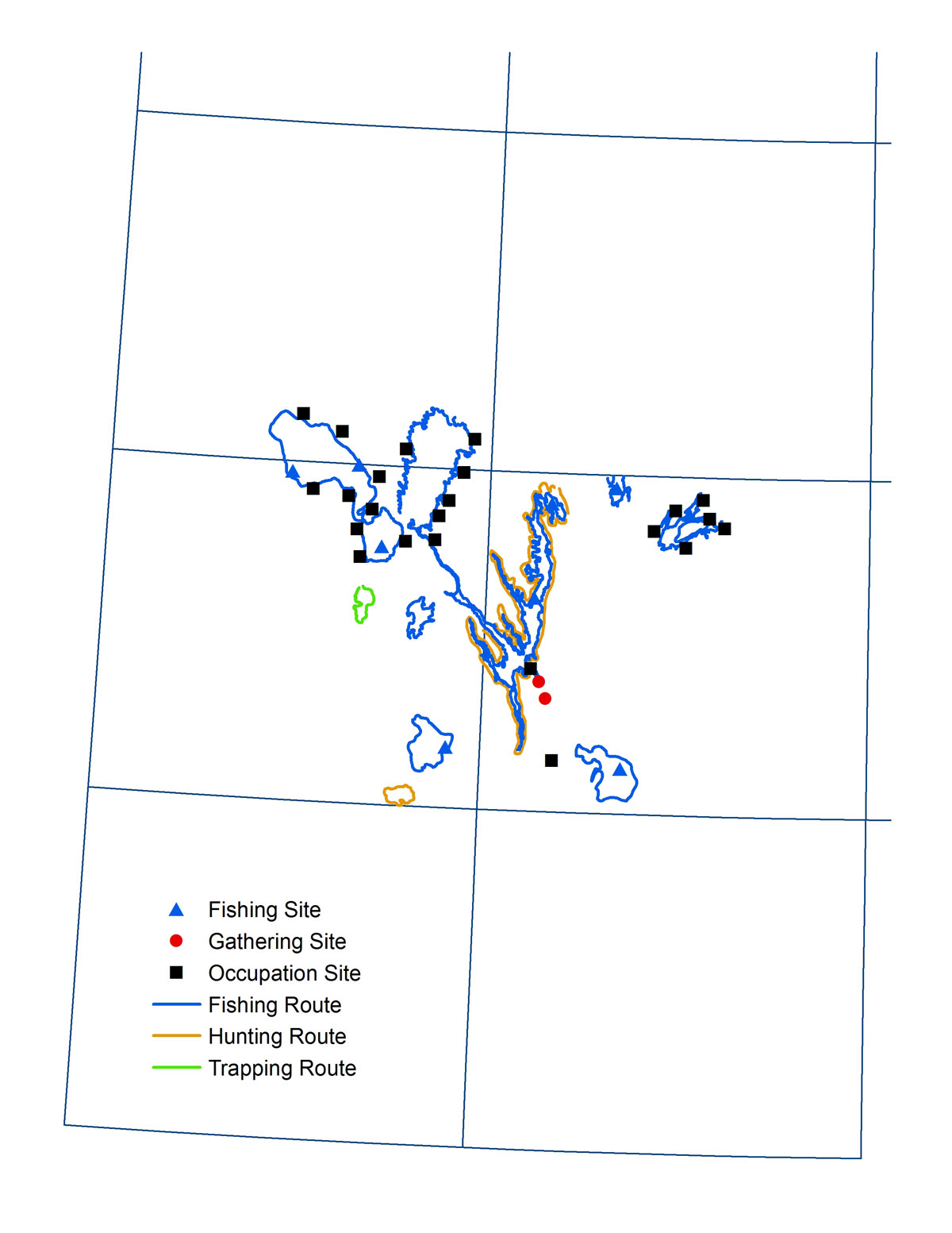
Next, the Lab created a carefully designed GIS to contain several different map feature types, including points (such as cabins, spiritual sites, and cemeteries), lines (like trapping and hunting routes), and polygons (such as lake fishing zones).
The associated attribute tables for each map feature were programmed with drop-down lists of options for digitizers to choose among. When the range of possible attribute information is limited, this approach speeds data entry and reduces error. Historical GIS Lab staff digitized geographic map features and added textual attributes as they went along. For example, each hunting route could be attributed to elk, moose, caribou, bear, or a dozen other species mentioned by interviewees, and season could be set as spring, summer, fall, or winter.
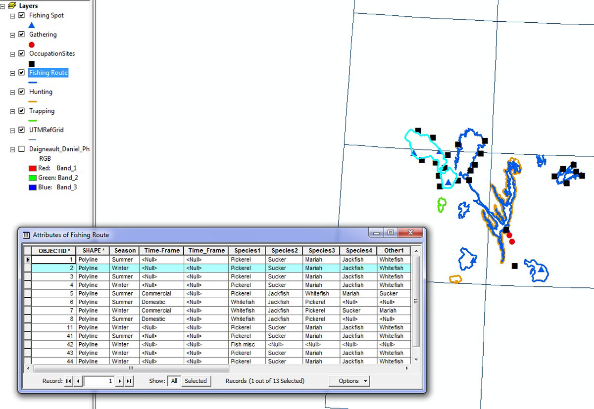
Once all 131 of the original mylar maps were digitized and attributed the Lab created full documentation for the GIS and organized a half-day training session for the researchers who would use it. Now in a GIS, it is possible both to disaggregate separate map layers, for example to analyze only the gathering points, and to combine multiple maps.