Traditional Land Use Projects
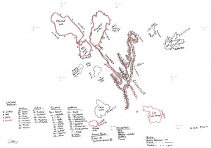
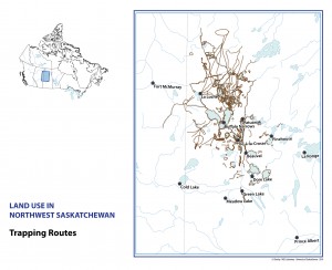
If your community is planning a traditional land use study, we can provide consulting services to help design the map collection procedures and train interviewers to collect map information in a rigorous manner. Afterward, we can convert field maps into a GIS that allows comparison and aggregation of multiple maps in one space. The combination of dozens or hundreds of maps drawn by individuals can represent the territorial extent of the entire community, and allow other types of analysis only possible with GIS.
We charge $40 per hour and will design the project to meet your goals.
Get in touch with us to request a price quote.