
Historical Map Digitizing
A basic task of Historical GIS is converting archival paper maps into dynamic, electronic formats. Once researchers have located historical maps of interest to them, we can assist in this conversion. Digitizing normally consists of four distinct steps:
Step 1
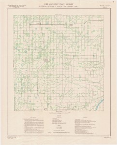
Scan or photograph paper maps to create electronic image files, typically .tif, .jpg, or .gif. This step creates pictures of the original maps that can be used for PowerPoint presentations, web sites, or print publication.
Step 2
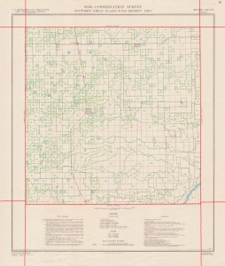
Georectify the scanned image to align the map with a geographical projection. Georectification is sometimes call “rubber sheeting,” because the process stretches the flat map to conform to the curved surface of the earth, as if it were printed on a sheet of rubber. This step tells the computer where in the world a map is. Most (though not all) historical maps can be georectified. To do so it must be possible to identify recognizable locations on the map. Typical examples include political boundaries (state, province, county, or city boundaries), street or river intersections, identifiable buildings, or marked latitude/longitude coordinates. Georectification makes it possible to import your archival map into a spatial analysis program like a GIS or GoogleEarth.
Step 3
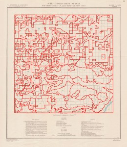
Digitizing map features is often the most time- and labor-intensive part of an HGIS project. In this step technicians pull georectified map images up on a computer screen, then use a mouse to trace features from the original map, including points, lines, and polygons. Typically map features are grouped into coherent layers. For example, all streets in one layer, buildings in another, land cover in a third, and rivers in a fourth. This process of grouping map features into layers helps later with map disaggregation and overlay with other maps. An important component of a digitizing project is “topological integrity.” The computer needs to know not only the shape and location of a map feature, but also its relationship to all other map features, especially characteristics such as adjacency. When this step is finished the historical map can be fully integrated into a GIS, compared to and combined with other digitized historical maps, and disaggregated for analysis.
Step 4
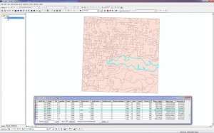
Adding attributes to map features is sometimes a separate step, but often occurs alongside digitizing. This process creates a spreadsheet-like table of data linked to the electronic map. The ability to analyze attributes is often the justification for all of this work. In this task we “teach” the computer not only the shape, location, and spatial relationships of each map feature, but also interesting attribute information about that feature. First we digitize the shape of all electoral districts, for example, then we add attributes about election results in each district.