
Historical Map Cartography
As powerful communication and analytical devices, maps should be included in many historical publications. Often a well-designed map can communicate historical information to readers faster and more directly than text. Historical maps serve not only to orient readers to a geographical setting, but can also contribute to analysis or further an interpretive argument. However many historical publications lack any maps at all, or include weak reproductions of maps created for other purposes.
The HGIS Lab can help you create useful and attractive maps for your journal article, book, or thesis. The historical research behind the map is up to you—then we’ll help you create maps that communicate information clearly to your readers.
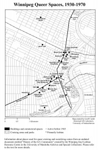
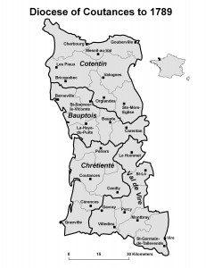
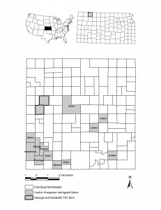
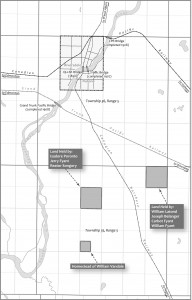
Here are some recent examples of maps we’ve created for historical publications:
Samples
Historical Cartography Package $350-$500
We’ll work with you to create a publication-ready map to your specifications for a fixed price.
YOU PROVIDE
- a rough sketch or mock-up of the map you imagine
- a description of your goals for the map—what message do you intend to communicate?
- raw geographical information—locations of map features to include, such as
- scanned source maps
- list of counties, provinces, voting districts, etc.
- list of street addresses
- publisher specifications, such as print size, resolution, file format, font, etc.
WE PROVIDE
- core map design
- a draft map for your review and correction
- a final publication-ready map
TERMS
- We assume you have completed the necessary historical research behind the map. If you need us to research the names, locations, or characteristics of map features we charge $40/hour with your advance approval.
- 50% payment due at initial agreement, 50% upon delivery.
- Final map delivery within 60 days of our initial agreement.
- Map includes an attribution to the HGIS Lab. Map authorship is listed as you first and our cartographer second.
- The HGIS Lab retains the right to use and redistribute the map, in print or electronic form, always with full attribution to you as first author and with a citation to your publication. If you wish to retain exclusive use and redistribution rights an additional $100 charge applies.
Get in touch with us to inquire about our Historical Cartography Package.
Custom Cartography Package
If your cartography project is complex, requires additional historical or geographical research, or includes multiple maps, we will work with you to prepare a custom job. We charge $40/hour and after a discussion about your needs we’ll prepare a work plan, time line, and price quote.
Get in touch with us to inquire about our Custom Cartography Package.